

Gush Chalav
- Mike Levitt

- Jan 2, 2023
- 23 min read
One day in early November 2022, after pre-walk fortification with mint choc chip ice cream at Buza's ice cream factory and outlet at nearby Kibbutz Sasa, Yonatan and I made a thorough tour of Gush Chalav (גוש חלב), also known as Jish (ג'ש, الجش).

Gush Chalav is mentioned in the Mishna (Arakhin 9:6) as having been walled since the times of Joshua ben Nun, nearly 3,300 years ago. Canaanite and Israelite remains from the Early Bronze and Iron Ages have also been found there. In classical times the town was called Gischala, a Greek transcription of the Hebrew name Gush Chalav, and Jish is an Arabic variation on the same name.

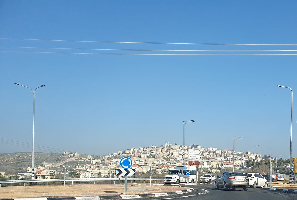
It is situated at an historically-important cross-roads. Nahal Gush Chalav (Wadi el-Jish)—which flows all year round—passes northeast of the village and along the river are the remains of six ancient traditional flour mills. There are many springs around the village, which drain into the valley, and this has contributed greatly to the flourishing of agriculture and traditional crafts in the village, and may be the origin of the village’s name, which means literally ‘block or mass of milk’, perhaps referring to the fertility of the land, or alternatively ‘block of white’, referring to the white limestone cliffs which rear up on the east side of the Nahal.

The village is situated on a lofty hill, consisting of limestone bedrock, whose slopes descend precipitously in all directions. At the top of the hill is an ancient tel with remains dating from the Early Bronze Age to the modern era. The tel has revealed an ancient synagogue which now lies beneath the church of Mar Boutros—more on that later—and numerous potsherds, fresco and other artifacts from the Middle and Late Roman periods, as well as remains, on the upper part of the slope, dating to the Hellenistic period, and a large cistern and defensive rampart probably from the time of the First Jewish Revolt against the Romans in 67 CE.
Gush Halav was the last Jewish stronghold in the Galilee and Golan region during the First Jewish Revolt against Rome (66-73 CE); its fall was described at length by Flavius Josephus, the Roman historian who, before he defected to the Roman side and was granted Roman citizenship, was Yosef ben Mattityahu, commander of Jewish forces in Galilee, until surrendering, after the six-week siege of Yodfat, in 67 CE. As was the case with other towns and cities in the Galilee, a dynamic Jewish presence continued in Gush Halav well into the second half of the second millennium CE. More on that later.

Today the village is a thriving town but, although many guidebooks refer to “the Arab village of Jish or Gush Chalav”, the vast majority of the town’s residents are not Arabs at all, but Maronites. Maronites are Syriac Christians who have been followers of a hermit known as Mar Maroun since the end of the 4th century, many of whom do not like their town to be referred to as an Arab village. And they are right: their origins—far from Arabia—are in Aram, a region stretching from Mesopotamia to the Mediterranean Sea which was also of course the origin of Avraham Avinu. This Semitic people, which spoke Aramaic, dispersed throughout the Middle East over the centuries. When the Arabs entered and conquered the region early in the 7th century, the Aramaeans in general and the Syriac Christians and, within them, the Maronites—those who had embraced Christianity—in particular faced forced conversion to Islam. Like the Jews, the Maronites refused to abandon their faith, for which they have faced continual persecution until this day. Most Aramaean Maronites sought safety into the Lebanese mountains, where—together with the Druze—they founded modern Lebanon in the early eighteenth century, through the ruling and social system known as the "Maronite-Druze dualism" in Mount Lebanon. Many of the Maronites were driven out of Mount Lebanon as a result of the Battle of Ain Dara in 1711, which was fought between the Druze Qaysi and Yamani tribo-political factions. According to Yitzhak Ben-Zvi, historian, Labor Zionist leader and the longest-serving President of Israel, it was at this time—and perhaps as a result of this battle—that Maronites first settled in Jish. Ben-Zvi recorded a local tradition, according which two families in the village preceded the Maronite immigration; One of them—the Hashouls, the oldest family in the village— were Maronites of Jewish ancestry and were originally known by the name Shaul. Notwithstanding, thousands more were killed in a bloodbath in the Syrian Civil War in 1860. The Maronites are recognised as a Christian ethnoreligious group: in September 2014, Gideon Sa’ar, as Minister of the Interior, broadened the legal definition of the group to allow Christian families who could speak Aramaic or had an Aramaic family tradition to register as ethnic Aramaeans (non-Arab), in addition to the roughly 200 Christian families who were so-eligible previously. It is estimated that there are 10,500 persons eligible to receive Aramean ethnic status, including 10,000 Maronites and 500 Catholics. Some members of the Arab community in Israel denounced registration of ethnic Aramaeans as an attempt to divide Arab Christians, and the Greek Orthodox Patriarchate officially denounced the move.

Mar Maroun was a deeply spiritual priest who decided to meditate in solitude in the mountains of what is today northern Syria; his many followers accepted the authority of Rome as Catholics who worshipped in their native tongue, so that today Maronites are the only Eastern Christian sect that is not split between Orthodox and Catholics.
Today, although the Maronites’ prayers are written in Aramaic, only the elders of most communities, together with a few scattered communities in Cyprus and Lebanon, still speak this former lingua franca which the Jews also shared—to this day certain Jewish documents and prayers are written in Aramaic, and much of the Kabbalah and part of the Talmud is written in Aramaic. In Jish, Shadi Khalloul, founder and president of the Israel Christian Aramaic Association (ICAA), has for many decades been working towards its revival as a way of re-connecting the population with its history, succeeding in bringing its teaching onto the school curriculum in Jish for pupils from first to eighth grade. Khalloul believes that Maronites in Israel and elsewhere in the Middle East—because they speak Arabic—have been swept into a nationalistic agenda for the entire Middle East, obscuring their true history and identity. You can read a recent interview with Khalloul (2022) here.
Unlike the Arabs, Israel’s Maronites have never raised attacked the Jews. Indeed there was much Maronite Zionism. During the 1939 Arab Uprising against the British Mandate, Maronites brought supplies on donkeys to the Jewish community in Tsfat (Safed). The Khalloul family, in Bir’im hid illegal immigrants, refugees from Nazi Germany, and aided them enter the British Mandate. Maronite leaders frequently sided with the Jews during the Holocaust years, and served as intermediaries in land purchases in the Hula Valley between Arabs and Jews. Nevertheless an injustice was perpetrated upon them during the War of Independence when the population of the Aramaen Maronite village of Bir’am they were told to leave their homes, and promised a speedy return. Most of them resettled “temporarily” in Jish, but five years after the evacuation, and despite a court decision in their favour, Bir’am was razed to the ground. I have explored this issue—whose cause is still today opaque—in a previous blog about Bir’am. Although Maronites are loyal to the Jewish State, they are not required to serve in the army: however almost all high school graduates join the army voluntarily or perform National Service.
Both Josephus and later Jewish sources from the Roman-Byzantine period mention the fine olive oil for which the village was known and, according to the Talmud, the inhabitants also engaged in the production of silk. Rabbi Eleazar ben Shimon, the son of the Rashbi, Rabbi Shimon bar Yochai, was a resident of the town. According to one version of events, he was initially buried in Gush Halav but later reinterred in Meron, next to his father. The fourth century Christian historian, Jerome of Stridon, recorded that Paul the Apostle lived with his parents in Giscalis in Judea, which is generally understood to be Gush Chalav.
During the Second Temple period, and in the centuries following the Great Revolt against Rome of 66-73 CE, Gush Halav was a thriving Jewish village. The famous Jewish warrior Yochanan Ben Levy (also known as Yochanan from Gush Chalav or John of Gischala) was a native of the town, and was one of the main figures of the revolt. Josephus states that on the eve of the rebellion against the Romans, the settlement made preparations for being besieged, and the fortifications there, ordered by Josephus, were paid for by Yochanan.
Victor Guérin, the French explorer and amateur archaeologist who visited Jish in 1863, wrote:
“Continuing to mount the hill, and at the moment of reaching the top, we remark the traces of a surrounding wall constructed of regular cut stones. As recently as 1863 there were still remaining considerable vestiges, but at present it is almost entirely destroyed, the stones having been taken away to build a new church [Mar Boutros, presumably]. These are the remains of the wall which once surrounded the acropolis of Gischala, whose name is preserved in El Jish”
Several subsequent excavations in the village have revealed that the fortifications were constructed in two phases as evidenced by two layers of soil and stone fill that are distinguished from each other by their ceramic composition and separated by a thin layer of soil. Almost the only contemporary parallel of fortifications that consist of ramparts are those at Yodfat. This method of fortification seems to have been chosen here because of the lack of suitable building stones, the bedrock being cracked and unsuitable. It is possible that a city wall was built atop the rampart, but the rampart itself meant that such a wall was unnecessary, with perhaps only a low wall being erected which did not require expensive masonry not immediately to hand locally. A concentration of some 250 different sized geodes (known as ‘Elijah’s watermelons’) were found at the bottom of the glacis on which the ramparts were constructed. These were natural rock balls with quartz crystals in their centre, which were brought from the Zivʽon River, about four kilometres to the west, to be used as weapons against the Romans.
After the Galilee and the Golan fell to the Romans, Titus’ conquering army laid siege to Gush Chalav, which was the last Jewish stronghold to fall. Outside the walls of the city, Titus called on its defenders to surrender. Yochanan prevailed upon Titus not to enter the city that day, as it was the Shabbat (Sabbath)—as Josephus records in The Jewish War—“not so much out of regard to the seventh day as to his own preservation.” Yochanan escaped to Jerusalem. However “Titus was greatly displeased that he had not been able to bring this Yochanan, who had deluded him, to punishment.”
In any event Gush Halav capitulated to the Romans without a fight. It thus continued to exist in the ensuing centuries, as evidenced in both documents and in archaeological finds, such as mikvaot (ritual baths) that indicate the presence of Jews who continued to practice purification rituals after the destruction of the Second Temple. The local inhabitants discarded refuse on the slope of the rampart but, due to the nature of the bedrock, which contains impermeable clay that becomes slippery on contact with water, there were repeated landslides from the side of the rampart, as noted in subsequent historical documents, and these were exacerbated during the earthquakes which occurred in 363 CE and in 1837.
How did Yochanan escape the heavily-surrounded walled city? Yinon Shivtiel, a lecturer at Tzfat Academic College who researches the history of the caves of the Galilee and is a member of the staff of the Israel Cave Research Center, has a theory, having discovered and part-mapped a network of hidden passageways discovered in Jish from the period. This fits with Josephus’ writings, where he speaks of the Romans after the battle of Jotapata (Yodfat) investigating “the hiding places and slaughter[ing] the people hiding in tunnels and caves.” In 2002, at the entrance to a house in Jish, Shivtiel was shown a wooden covering which, when opened, revealed the entrance to a cave and 25 metre hewn passageway, with branches, amazingly similar to those found in the Judean lowlands, associated with the Bar Kochba rebellion, 60 years after the Great Revolt. He claims that at least fifteen other homes in Jish have beneath them hidden passageways.

Furthermore, there are two cave openings—one above the other—in the cliff northeast of the ancient synagogue in the riverbed of Nahal Gush Chalav, which Shivtiel explored with the Israel Cave Research Center the same year. The lower opening leads to a main tunnel-like hole with two more branching off from it. The upper opening leads to one main tunnel. Both openings were a result of natural processes of erosion, but the tunnels behind them bear signs of hewing. Shivtiel admits that it is difficult to determine if the tunnels are manmade or a natural phenomenon that was utilized. However they mapped the 27 metre long lower tunnel, which cuts through to the other side of the cliff, leading directly to one of the springs whose water flows into Nahal Gush Chalav. Shivtiel believes that the defenders of Gush Chalav not only surrounded the village with a fortified wall, but also dug hidden passageways through which they could escape, if necessary, or bring provisions to sustain the inhabitants during time of siege, as well as passageways that ran under the city wall to the spring, providing access to water. Josephus describes using tunnels in this way during the siege of Jotapata (Yodfat): “Via a narrow crevice that was difficult to traverse in the western part of the valley where the Romans did not look, he sent letters to Jews in distant places and received gifts from them, until he had many and various foods that the residents were already lacking.”
Conder and Kitchener—in their 1881 Galilee volume of PEF’s Survey of western Palestine—write: “At this village there are a large number of well-dressed stones with a draft cut round the edge; these are scattered about and dug up by the peasantry; they probably formed the fortifications of el Jish in the times of Josephus, when it was known as Giscala.” These have long vanished. However they also mention sarcophagi, of which more later.
So Yochanan’s successful escape, under the nose of Titus, was probably achieved in this way; afterwards he continued to fight in Jerusalem, as described in detail by Josephus:
“Yochanan...went about among all the people, and persuaded them to go to war, by the hopes he gave them. He affirmed that the affairs of the Romans were in a weak condition, and extolled his own power. He also jested upon the ignorance of the unskilful, as if those Romans, although they should take to themselves wings, could never fly over the wall of Jerusalem, who found such great difficulties in taking the villages of Galilee, and had broken their engines of war against their walls. These harangues of Yochanan’s corrupted a great part of the young men, and puffed them up for the war.”

Yochanan played a part in handing Jerusalem over to control of the Zealots. He attempted to set himself up as ruler of Jerusalem but was challenged in April 69 by Simon Bar Giora. They were both in turn challenged by a third faction led by Eleazar ben Simon. In the ensuing factional fighting, Yochanan was finally captured by Titus during the Siege of Jerusalem, taken to Rome where he was paraded through the streets in chains, and sentenced to life imprisonment.
The town had at least two synagogues: the ruins of one were incorporated into the foundations of a Melkite Greek Catholic Church of Mar Boutros, perched at the summit of the upper town (Melkites—who make up about 10% of the population of Jish—are followers of various Eastern churches of the Byzantine Rite); the other is on the edge of the lower town on the slopes of Nahal Gush Chalav.
The former of the two synagogues is no longer visible. In 1863, Victor Guérin noticed ancient archaeological fragments near the top of the tel: “On the plateau are the remains of a […] synagogue, of which, at my first visit, there remained four shafts and other ruins. These remains are now dispersed and lost.” Captain Charles Warren, an archaeologist of the Holy Land, and particularly of the Temple Mount, noted fragments, including corner column bases, in 1869. The church of Mar Boutros is the ‘modern church’ referred to by Conder and Kitchener, who record that “Scattered about in the village, near the modern church, there are columns, capitals, and bases of a synagogue, which was probably one of considerable size. The site of this synagogue is not distinguishable, but it was very probably where the church now stands. A great many stones in the walls of the modern church show by their workmanship that they came from a synagogue. There is also an attached pilaster built into the wall, and pieces of sarcophagi in the walls of the houses. The ruins of this synagogue show that it was built of very white limestone.”


Columns and other masonry from the synagogue, now buried beneath Mar Boutros
The current church is less than a hundred years old, either having been rebuilt or re-faced since the nineteenth century, since none of these pieces of synagogue masonry is visible in the walls today, but some of this ancient masonry remains used as a kerb in the adjacent parking area. Apparently the rest of the elements are in a private courtyard which we could not find, with one in the Meron field school.

The lower synagogue attracted the attention of Ernest Renan, the French Orientalist and Semitic scholar who conducted the first major archaeological mission to Lebanon and Syria in 1860-61. (Incidentally Renan, as well as being among the first scholars to advance the now-discredited Khazar theory, which held that Ashkenazi Jews were descendants of the Khazar converts to Judaism, was an antisemite, claiming that the Semitic race was inferior to the Aryan race.) It also was visited and documented by Guérin in 1863.
“The Ain el Jish flows into a deep ravine planted with fig-trees, pomegranates, and vines, overlooked by the lofty hill of El Jish. Above the fountain and the valley, and at the foot of the hill, is seen a platform partly artificial and partly natural, as is proved by the foundations of a sustaining wall in great blocks, some courses of which are still in position. On this platform are the ruins of an ancient synagogue now completely destroyed. The building, like most of those of its kind, measured about twenty-two paces in length by thirteen in breadth. Three bases of columns are still buried in the soil on the spot where they stood. Several broken shafts are scattered here and there, together with the fragments of two abutments and a lintel of a door decorated with mouldings. I could not find the column on which M. Renan in 1860 had discovered his Hebrew [sic] inscription [of which more later, Ed.]. The hill of El Jish rises by successive stages and terrace sustained by great blocks of stone, some of which appear ancient.”

The synagogue was again described by Conder and Kitchener in 1881 (who also quoted Guérin):
“To the east of the town, half a mile distant, there are the remains of another synagogue; it is situated above and to the west of the great valley of el Jish [Nahal Gush Chalav], on a levelled plateau. There still remain the bases of three columns and the stone door-posts of the southern door in situ. There are also traces of the walls. This seems to have been a small synagogue, like the smaller one at Kefr Bir'im. The remains are like those of Nebratein: no capitals, but portions of lintels, columns, and double columns are Strewed about. The outside dimensions are 58' long by 37 feet wide having a doorway, 5' wide, in the centre of the south wall. The special plan will show the remains and also the form of the moulding of the lintel and a peculiar stone, carved with representation of a Roman eagle. On one of the fallen columns there is a much defaced inscription, probably written by some Jew who came to lament over the noble buildings of his ancestors. There is also a small scrap of ornamented stone that may have been a portion of a capital.”


The "scrap of ornamented stone that may have been a portion of a capital" (left) and plan and capital from the synagogue (right), as depicted by Conder & Kitchener [Public Domain]


The lintel carved with a sculpted eagle (left in 1977, Public Domain, right today) was a common decoration in synagogues of the Galilee and Golan at this time.
However, the “much defaced inscription, probably written by some Jew who came to lament over the noble buildings of his ancestors,” as Conder and Kitchener so disparagingly averred, is somewhat confusing, bearing in mind Guérin’s note, which I already quoted, that “I could not find the column on which M. Renan in 1860 had discovered his Hebrew [sic] inscription.” This needs further untangling.
Renan published a just-decipherable dedicatory inscription on a column that he transliterated from the Aramaic as “ywsh br nhwm/ ‘bd h’dn/ i’h lh/ brkth”, and translated as “Yosa Ben Nahum made this [column?], May it be for him a blessing.” Guérin, as we have seen, noted that he could not find the column. Conder and Kitchener repeated the text, mistaking it for Hebrew; “On one of the columns of the synagogue was a Hebrew inscription which may be translated: ‘Joseph Bar Nahum built this arch. May a blessing fall upon him!’” They continue, “The column and inscription have now apparently disappeared, as they were not seen by Lieutenant Kitchener or by M. Guérin.”
So the “much defaced inscription, probably written by some Jew who came to lament over the noble buildings of his ancestors” of Conder and Kitchener is clearly another inscription altogether. Indeed they publish an uncaptioned drawing of an inscription, which does not match that published by Renan; neither is the script entirely clearly either Aramaic or Hebrew, but it no doubt represents their “much defaced inscription.” I cannot be certain it matches an inscription on an extant pillar at the site, but it likely does; judge for yourself!


An inscribed pillar (left; Credit: Bukvoed, CC) is not the one first seen and deciphered by Renan; it may however be that transcribed bt uncaptioned by Conder & Kitchener (right, Public Domain)
Kohl and Watzinger—whom we shall mention again below—republished the Renan inscription in 1916, and it has since been republished more than a dozen times including, in 1978, by the specialist in inscriptions and scripts, Joseph Naveh, professor of West Semitic Epigraphy and Palaeography at the Hebrew University of Jerusalem who, between 1955 and 1971, was employed in the Israel Department of Antiquities (now the Israel Antiquities Authority). Only Renan had seen the original.
It was the German scholar and architect, Heinrich Kohl, who carried out the first excavation during the summer of 1905, leading the Synagogue Expedition of the Deutsche Orient-Gesellschaft there from June 14-17, as part of an extended study of eleven Galilaean and Golan synagogues. Together with Carl Watzinger, the German archaeologist, who with Ernst Sellin, worked on uncovering the site of the ancient city of Jericho, Kohl recorded architectural fragments in secondary use in the village, as well as making a general excavation of the eastern part of the lower synagogue. However their non-stratigraphic approach meant that they were unable to interpret the plan or history of the building, which was found to have had four building phases when it was excavated by Eric Meyers, Carol Meyers and James Strange of the Meiron Excavation Project in 1977-78.

The earliest phase, from 250-360 CE, was a basilical synagogue with two rows of four columns dividing the hall into a nave and aisles. Benches were built along the west wall and at the northern end of the nave, and a large bima (platform) stood on the west side of the main entrance. The floor was partially plastered. There was one main entrance in the south wall and two interior entrances in the east and west walls. Possibly, there was also a door in the west wall that led to a western side room. This door might have been blocked by debris after the earthquake of 363 CE, which marked the end of the second phase (which started in 360 CE). During this second phase there were extensive renovations to the walls, stylobate, and other architectural members, which were recut and reset, and it is possible that a mezzanine was added to the structure. In the third phase, from 363-460 CE, the synagogue was renovated, and the bima was raised and reduced in size. During the fourth phase, from 460-551 CE, the ground plan remained unchanged, but the floor was renewed in the western corridor. Thus the floor plan for the different phases is nearly identical: a rectangular basilica with eastern, western, and northern side rooms.

A hoard of 1,943 badly worn minimi coins was found in a cooking pot, buried near the doorway to the synagogue hall in the western corridor. These were coins of the lowest possible value, spanning a range of 188 years (330-518 CE), not including two Hasmonean coins dated earlier than 330 CE. It was clear that the coins were placed in the pot upon a floor for storage, and not hidden or dug into a pit of any kind.
You can enjoy a 3D tour of the synagogue here, thanks to the Kripke Center at Creighton University of Omaha, Nebraska, named for Rabbi Myer Kripke z”l, who died on April 11, 2014 at the age of 100, and his wife, Dorothy.


The main (southern) entrance to the synagogue (left); the synagogue from the north east (right)
Guérin noted in 1863 that “The lower slopes of the hill are pierced by numerous sepulchral caves, almost all partly destroyed or blocked up.” Conder and Kitchener record that “there are […] several sarcophagi dug up by the peasants and lying about; they are ornamented with conventional bands; these occur on the south side of the village.” Although none of these ‘dug up’ sarcophagi are to be seen today, between 1938 and 1942, N Makhouly, an archaeologist working for the Department of Antiquities of the British administration of Mandatory Palestine, the predecessor of the Israel Antiquities Authority, excavated a complex 4th century CE mausoleum, containing lead coffins, stone sarcophagi, loculi caves, and plastered burial chambers, plans of which can be seen here.
In 1973, Ntanel Velenksky cleared anther 4th century CE mausoleum on the western side of the village, similar to those seen at the large Jewish catacomb at Beit She’arim National Park. The mausoleum has been preserved. It was built of ashlars and stood in a courtyard which was reached by a flight of stairs. From the courtyard there were entrances to the burial caves. Above the northern cave is a room with was found a large double sarcophagus, each with a gabled stone lid. The mausoleum is today in the basement of a house and is open to the public but was closed when we visited. The mausoleum—whose stone door remains intact—contains ten hewn burial caves or loculi (kokhim) where archaeologists found several skeletons, oil lamps and a glass bottle dating to the fourth century CE.

In addition to Jewish burial sites and structures dated to the 3rd through 6th centuries, both Jewish and Christian amulets have also been discovered in and around Gush Chalav. Since archaeological finds from the Byzantine period were discovered only in the western and eastern parts of the village, it is thought that, after the earthquake of 363 CE, most of the settlement moved to Nahal Gush Chalav, where the ruined lower synagogue is located. Although the site is isolated and pastoral now—with no obvious sign of settlement except for the synagogue—the 1977-1978 excavation was able to carry out preliminary limited work on the eastern side of the synagogue, finding domestic structures built right up against the synagogue walls, as is known from other synagogue excavations. It was only during the Middle Ages that the settlement moved to its present location on the southern slope of the hill. The top of the tel, where the church of Mar Boutros now stands atop the site of the upper synagogue, was not redeveloped.


The tel north of Mar Boutros has not been resettled or excavated (left); nevertheless the ground is littered with potsherds (right)
Historical sources from the Middle Ages (10th-15th centuries CE)—including some in the Cairo Geniza—describe Gush Chalav as a large Jewish village, and the Arab geographer, Al-Muqaddasi, mentions it in the 10th century. In 1172, the Jewish traveller Benjamin of Tudela found about twenty Jews living there, and Ishtori Haparchi—the pen name of the 14th century Jewish physician, geographer and traveller, Isaac HaKohen ben Moses—describes attending a megilla reading when he visited in 1322. Eliakim Carmoly’s Itineraires de la Terre-Sainte of 1847 records that the village contained in the thirteenth and fourteenth centuries the tombs of several illustrious Rabbis, an ancient synagogue, and a school. Even in these periods the village remained on the upper slope, and there was a large cemetery on the lower slope to the south where the modern village has extended. Of this cemetery, a number of tombs of Jewish sages (tzadikim) remain to this day, and are well-kept and frequented by pilgrims. These include the Tomb of Rabbi Meir Bar Yitzhak Halevi, an eleventh century and composer of piyot, the grave of Yochai & Sara, parents of Rabbi Shimon Bar Yochai, the Rashbi, whom we commemorate at Lag B’Omer, and is buried in nearby Meron. There are also graves of Avtalyon and Shmaya, converts to Judaism or the descendants of converts; by tradition they were descended from King Sennacherib of Assyria but, despite this, they were influential and beloved. To the north west of the village is a further grave site which Jewish tradition identifies with the prophet Yo’el (Joel). You can read more about these tombs of the sages, and see more photos, here.

In 1596, Jish appeared in Ottoman tax registers as being in the Nahiya (sub-district) of Jira, of the Liwa (district) of Safad (Tzfat), by which time its population of 71 households and 20 bachelors were all Muslim. By the 17th century, the village was inhabited by Druze, and the Turkish traveller, Evliya Çelebi, visited in 1648, writing, “Then comes the village of Jish, with one hundred houses of accursed believers in the transmigration of souls [that is, Druze]. Yet what beautiful boys and girls they have! And what a climate! Every one of these girls has queenly, gazelle-like, bewitching eyes, which captivate the beholder—an unusual sight.”
As mentioned above, Maronites may have first settled in Jish during the early 18th century. Certainly by the time of the Galilee earthquake of 1837—which caused widespread damage and over two hundred deaths—Jish was noted as a mixed Muslim and Maronite village. According to the 19th century traveller, writer and minister of the Church of Scotland, Andrew Thomson, no houses in Jish were left standing. The church fell, killing 130 people and the old town walls collapsed. A total of 235 people died and the ground was left fissured. However by the end of the 19th century, Jish had recovered and was described by Conder and Kitchener as a “well-built village of good masonry” with “about 600 Christians and 200 Moslems.”
At the time of the 1922 census of Palestine, Jish had a population of 721 comprising 380 Christians—of whom71% were Maronite and 29% Greek Catholic (or Melchite)—and 341 Muslims. By 1945 this had grown to a population of 1,090 with 350 Christians and 740 Muslims.
Om 29 October 1948, during the War of Independence, Jish was captured as part of Operation Hiram, a three-day military operation which aimed at capturing the Upper Galilee region from the Arab Liberation Army (ALA) forces led by Fawzi al-Qawuqji and a Syrian battalion. The ALA had headquarters in Jish and four other towns. The 7th Armoured Brigade fought off a counter-attack of ALA and Syrian units at Jish on the morning of 29th. The inhabitants of Jish were largely not the target of the battles, although a number of civilians were killed. Although it is often said that many of the residents of Jish were forced to leave the village in 1948 and fled to Lebanon and became Palestinian refugees, those that fled were the occupying armies of the ALA and the Syrians, along with most of the Muslim residents of the village. The latter—who had formed the majority before the battle—were replaced by Christian refugees from the surrounding villages that were destroyed, including most of the residents of the village of the Maronite village of Bir’im. Today (November 2022) there are 3,166 residents of the town, of whom 65% are Christian (55% Maronites and 10% Melkites) and 35% Sunni Muslims.
Today the built-up area of Gush Halav still comprises units of traditional residential buildings, where clusters of several units create built groups of blocks and neighbourhoods divided by an organized yet organic network of streets and alleyways. Most of the extant buildings were erected after the earthquake of 1837. An urban survey in 2005 identified thirty-six buildings of architectural value, six abandoned buildings and six deserted areas with impressive remains of architectural elements. A typical residential unit is characterized by a courtyard house plan, typical of the Mediterranean basin. The dwelling is typically divided into areas and levels meant for family members or animals, with the inner courtyard representing the centre of family activity, although physically the courtyard is usually found at the front of the building, functioning as a partition between the private areas and the public street, from which it is separated by a massive wall with an entrance gate. The courtyards frequently host vine arbours which provide shade and tranquillity. Plaster decorations in geometric forms adorn the columns and the traditional ovens inside the structure, a feature which is also characteristic of other villages in the Upper Galilee. Some pictures from around the old town form a slideshow below.


The houses are built for the steep topography of the village, and to withstand earthquakes, having a low construction with stone walls, 70-80 cm wide, that surround the building on all sides, and one to four rows of stone structural arches that rest on the walls and a central circular column. These arches divide the space and reduce the roof span, most of which are made of tree branches, although in some cases groined and barrel vaults. The walls facing the slope of the hill are built away from the terrace wall or cliffside, forming a narrow, elongated, rectangular space of massive stones which fulfils a number of functions: preventing dampness from penetrating into the wall of the house and providing support during an earthquake. The space is generally used for storage.
The old Maronite Church of Al-Saida (the Virgin Mary) is in the upper village. The church is a cruciform vault supported on four columns. It was destroyed by earthquake with the loss of dozens in 1837, and rebuilt afterwards, with a new belfry added in 1974. It is rarely opened today and not in regular use since, at the end of the twentieth century, the enlarged congregation built a large, new, Maronite church of Mar Maroun (Maro) at the foot of Jish’s south-eastern slope in the lower village. It was begun in 1981 and completed in 1995 and built with funds raised among Maronites here and abroad. The church can hold 1,000 people. Below the church is a library and community facilities. While excavating a retaining wall foundation for the courtyard, a large concentration of human bones was exposed east of the church building. Due to the sensitivity of dealing with ancient tombs, no excavation, anthropological study or gathering of artifacts were performed, after it was noted by the antiquities inspector of the Israel Antiquities Authority.


The old Maronite Church of Al-Saida (Virgin Mary) (left) and interior (right)


The ancient ornamented lintel, shown in situ in a photograph of 1947 taken by the Department of Antiquities of the British administration of Mandatory Palestine (left, Public Domain), was removed during renovations and is now on display, somewhat damaged, in the garden of the church (right)

In December 2010, a hiking and bicycle path known as the Coexistence Trail was inaugurated, linking Jish with Dalton, a neighbouring Jewish village. The 2,500 meter-long trail, accessible to people with disabilities, sits 850 meters above sea level and has several lookout points, including a view of Dalton Lake, where rainwater is collected and stored for agricultural use.


The Coexistence Trail (left) and the view of Jish from the trail (right)
Comments